The invisible mountain pass between South Mountain and the Estrellas

I live in Glendale, Arizona, a suburb of Phoenix, and it was only recently that I realized that there's a mountain pass between two ranges just south of me, South Mountain and the Estrellas. A very big mountain pass! And it seems to be invisible to most people living in Phoenix.
It's invisible to most people because, if you're like me, the mountain range south of Phoenix is simply "South Mountain". It isn't. South Mountain only goes as far as 51st Avenue, then there's a large pass, and then the Estrellas begin.
I discovered this a couple of years ago when I started learning about the plans to complete the freeway loop, and people were saying that it would have to be built "through the mountain". So I decided to take a look. Ride along with me.
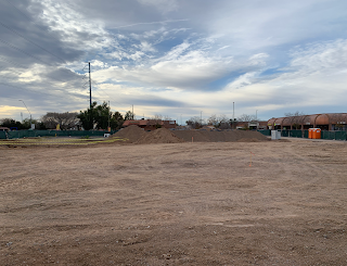
To see the invisible mountain pass, you need to go south on 51st Avenue. If you're familiar with the area, which is Laveen, on down to the Gila River Indian Community, you know that it's more than just a narrow mountain pass, it's actually very wide, with room to build a freeway without ever touching a mountain.
It's actually an amazing place to visit. So few people know about it that it seems so very far away from Phoenix. But it isn't, it's just invisible.
Image at the top of this post: 1935 map of the Phoenix area. Look for the mountain pass between the Estrella Mountains and the Salt River Mountains (nowadays called South Mountain).
If you like pictures of old-time Phoenix, please become a member of History Adventuring on Patreon. I share a LOT of cool old photos there, copyright-free, with no advertising. Your support makes it happen! Thank you!


Why is Goodyear southwest of Chandler? Am I seeing that correctly?
ReplyDeleteYes, that's correct. The map is from 1935, and Goodyear didn't move to the west valley until after WWII
DeleteWow, very cool. Thanks for the education.
Deletethe full name of the village South of Chandler is Goodyear Farms
DeleteHey Brad, can you help me out? My folks bought in the new development at 51st and Mountain view in the 70's. Mom swears they picked that spot because it was a quiet dead end road that ended where 51'st ave is now, at a small hill. She says the hill was demolished to build 51st ave, but I cant find any old maps of the area that show the topography of that area at that time. Do you happen to have anything that might be of use?
ReplyDeleteI see nothing here, but I suppose it's possible https://www.topoquest.com/map.php?lat=33.56948&lon=-112.17374&datum=nad83&zoom=4&map=auto&coord=d&mode=zoomin&size=m&cross=on
Delete