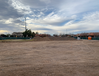
Beginning exploring Block 77, Phoenix, Arizona
I'm always exploring, and recently I started poking around Block 77 in Phoenix. It was the original business district, and its where the western block of CityScape is now, and where Patriot's Square Park was from 1976 to 2009. Block 77 is between Washington and Jefferson and Central and 1st Avenue.
If you're wondering why I'm calling it Block 77, it's because the original platting of Phoenix in 1870 was divided up by Blocks. The original town was laid out by William Hancock, the County Surveyor, who walked from the northeastern edge (what is now 7th Street and Van Buren) and counted off blocks to be sold to create the city.
When he got to Central Avenue (what was originally called Centre), he turned south and walked back to the eastern edge of town again. Then, as you see in the map from 1881, he kept going, and created what seems like strange zig-zag numbering system, until you realize that he was walking, and he stopped in what would be the center of town each time. By the way, as you've probably already guessed, Phoenix kept the naming of the east-west streets (which were Presidents), but it abandoned the names of Indian tribes for the north-south streets, and went with numbers, using Avenues on the west side of Central, and Streets on the east side.
So the two blocks that are now CityScape, as you can see, are Blocks 77 and 22, and that's why they're right next to each other.
 |
| The Business District of Phoenix in 1915. You're looking north from Jefferson up Central. The building in the foreground became Roy's. Block 77. |
My fascination with Block 77 started very recently, when I found that there are very few photos of it. I collect old photos of Phoenix, and I have a LOT of photos of Central and Washington. But the vast majority of those photos are looking north, northeast, or southeast. Very few are looking southwest, at Block 77. So naturally I was curious. And it's the same with photos of Jefferson and Central - most of them look northeast, very few look northwest, like the photo in the old postcard there, which is rare. Phoenix didn't like to look at Block 77, or show it off, and I think that I know why.
From what I'm learning, Block 77 wasn't exactly the kind of place that your average shopper, or tourist, went to. If you're familiar with an area called "The Deuce", which was centered over by Madison and 2nd Street, you know that it was an area that became filled with crime, beginning with Prohibition in the 1920s. And while Block 77 isn't in the same area as what is traditionally called "The Deuce", it looks like it had the same type of situation.
This is what I know so far about Block 77 - that the buildings there were mostly built in Territorial times, and that, unlike the rest of downtown Phoenix, it stagnated. New buildings, and businesses, were popping up all over downtown Phoenix in the 1920s and '30s, but not on Block 77. It was not an attractive area for investment. At least not the kind of investment that banks make, if you know what I mean.
 |
| Looking southeast over Block 77 in the 1970s, after the completion of Patriot's Square Park. This is the intersection of Washington and 1st Avenue. |
I personally have no memories of Block 77, it was gone by the time I got to Phoenix, and in the place of that block the city had built a park. That park I remember well, as I used to wander around downtown Phoenix when I worked there in the '90s. From the people that I've talked to about the area, the park was an improvement, in spite of the fact that most of the time it was just a place for homeless people to hang out (they were moved out during special events, but they came back to the park).
I will continue to explore Block 77, and I'll let you know what I find. It may not be pleasant, but that's OK with me. I don't need my history to be all squeaky-clean, I'm a grownup, and I understand that everything isn't going to be that way. Looks like Block 77 began as a business district, and became a place of pawn shops and places much less respectable.
Thank you for exploring with me.
If you like pictures of old-time Phoenix, please become a member of History Adventuring on Patreon. I share a LOT of cool old photos there, copyright-free, with no advertising. If you like Phoenix history and would like to help support my efforts to preserve and share precious digital historic images, please consider becoming a patron. Thank you!
Become a Patron!


Comments
Post a Comment