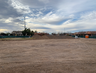
The mountains that make the valley of the sun, Phoenix, Arizona
I've often heard the Phoenix area described as "the valley of the sun". And a valley is simply an area surrounded by mountains. The mountains that make up the valley of the sun are: 1) the White Tanks to the west, 2) the McDowell Mountains to the east, 3) the Phoenix Mountains to the north, and 4) South Mountain to the south.
This is the Salt River Valley, which is also a way to describe "the valley of the sun", although not as glamorous a name, so the Chamber of Commerce went with "Valley of the Sun". Because, really, who wants to live in a valley of salt?
I've lived in the Phoenix area for a long time, but it's only been recently that I've been trying to figure out the geography of it. I like old photos and often the only thing that remains the same is the shape of the mountains in the background. Of course nowadays most intelligent people are watching for traffic, and using their GPS, which is why it's wise to not let me drive, because I like looking out the windows at the mountains. It has occasionally worried people that I've given directions to to "drive to the mountains" and "keep the river on our right". Yes, I know the name of the streets, and how to get to places in the valley, but I like looking at mountains. I can get around the valley by looking at the mountains, and the canals, the same way that I could ride my bicycle as a kid in Minneapolis, by just knowing my way with landmarks, and really having no idea what the streets were called.
This valley, by the way, tilts ever so slightly towards the southwest, so water that falls in the northeast valley eventually trickles its way down to the Gila River, which goes to the Pacific Ocean south of Yuma. When I lived in California I remember seeing the storm drain covers which reminded people that the water drains to the ocean, and it does, even in Phoenix. Run your finger on a map of the Phoenix area from the northeast valley down to Tres Rios, and then you can follow the water all of the way to the ocean, along the Gila River. When it rains I like to imagine the rainwater flowing down to the ocean, at the Gulf of California. If you can see this stuff, you may not be a very safe driver, or a responsible adult, either!
So that's the valley of the sun, the place I call home, and the mountains that surround me are like the faces of old friends. I like it here. Thank you for sharing it with me!
Image at the top of this post: The Phoenix Mountains as seen from 27th Avenue and Southern in 2018. You're looking north towards downtown Phoenix.
If you liked this article, and would like to see more, please consider becoming a patron of History Adventuring on Patreon. If you're already a patron, thank you! You make this happen!
Click here to become a Patron!
History adventuring posts are shared there daily. The basic tier is a dollar a month, and the PhD tier, which includes "then and now" photos, billboards, aerials, videos, and super high-definition photos, is five dollars a month, and is discounted for seniors, veterans, and students.


Comments
Post a Comment